Al Rigga (Ar Riqqah)
Al Rigga or Al Riqqa (الرقة) is a locality in Dubai, United Arab Emirates (UAE). Located in the heart of eastern Dubai in Deira, Al Rigga is a residential and commercial centre. Al Rigga is bordered by Rigga Al Buteen, Port Saeed, Al Muraqqabat and Naif and bounded to the south by Dubai Creek.
Al Rigga is bounded in the west by route D 88 (Omar bin Khattab Road) and to the east by route D 78 (Abu Baker Al Siddque Road). The locality is separated from Al Muraqqabat by Al Rigga Road and from Rigga Al Buteen by route D 89 (Al Maktoum Road). The Union Square is located in Al Rigga where buses and taxis provide transport within the emirate as well as to other emirates in the country. The Dubai Clock Tower, which lies at the intersection of Umm Hurair Road and route D 89 is situated in Al Rigga. Additionally, several local hotel chains such as Metropolitan Palace, Zain International Hotel and Sun & Sands Hotel are located in Al Rigga.
Local roads in Al Rigga follow a grid pattern, continuing in numerical sequence from those of Al Muraqqabat. Even-numbered streets progress in a northwest–southeast pattern, beginning with 3rd B Street (near Al Tahir Restaurant) and ending with 45th C Street (near Metropolitan Hotel). Even-numbered streets progress northeast–southwest, beginning with 2nd Street (near Bani Yas Cemetery) and end with 44th A Street (near Rigga Al Buteen Plaza).
Both Al Rigga and Al Muraqqabat play a central role in the Dubai Shopping Festival (DSF) celebrations. Planet Pepsi, a DSF entertainment park is located in Al Rigga.
Al Rigga is home to the country's first mall, Al Ghurair Centre, and the first McDonald's branch. Built in 1981, both continue to thrive to this day and have undergone renovations in recent years to keep up with the times.
Map - Al Rigga (Ar Riqqah)
Map


Country - United_Arab_Emirates
 |
 |
| Flag of the United Arab Emirates | |
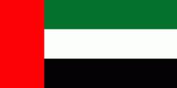
The United Arab Emirates is an elective monarchy formed from a federation of seven emirates, consisting of Abu Dhabi (the capital), Ajman, Dubai, Fujairah, Ras Al Khaimah, Sharjah and Umm Al Quwain. Each emirate is governed by an emir and together the emirs form the Federal Supreme Council. The members of the Federal Supreme Council elect a president and vice president from among their members. In practice, the emir of Abu Dhabi serves as president while the ruler of Dubai is vice president and also prime minister. In 2013, the country had a population of 9.2 million, of which 1.4 million were Emirati citizens and 7.8 million were expatriates. , the United Arab Emirates has an estimated population of roughly 9.9 million.
Currency / Language
| ISO | Currency | Symbol | Significant figures |
|---|---|---|---|
| AED | United Arab Emirates dirham | دإ | 2 |
| ISO | Language |
|---|---|
| AR | Arabic language |
| EN | English language |
| HI | Hindi |
| FA | Persian language |
| UR | Urdu |